

footflow™ and AI
footflow™ is a solution for the increasing number of organisations looking for reliable tools for footfall modelling, pedestrian movement analytics and geospatial intelligence.
footflow is not a typical AI-driven application
People often ask us about the role of AI in footflow, a question that doesn’t come as a surprise in a world where most business processes are expected to be accelerated or automated by AI. Yet the purpose of footflow has never been to simply accelerate an existing workflow. Our aim is to reshape how vital decision-making metrics are presented, make them accessible to a wider range of users and strengthen their role in scenario testing.
This naturally leads to the question of whether footflow should be considered an AI solution. This is difficult to answer as a binary yes/no question. The best way to understand footflow is through its outputs – consistent and granular footfall and pedestrian proximity metrics. Its goal is not defined by the technology and processes used in generating these outputs.
footflow currently uses some machine learning
Today, footflow relies on advanced spatial and statistical models, akin to more traditional forms of machine learning. This approach is deliberate, but more time-intensive than more modern AI tools. This raises the question of whether we could simply turn to more advanced AI methods and bypass some of these steps.
The simple answer is that we don’t have a reliable source of ground truth that we feel comfortable using as a training data source. We know that the definition of pedestrian infrastructure requires learning from multiple datasets with multiple layers of bias. Pedestrian infrastructure is conceived in very different ways by a wide range of professional silos who (for entirely valid reasons) operate with their own objectives, norms, conventions and ultimately biases. Just think of how differently pedestrian infrastructure is viewed in highway engineering, shopping mall leasing or operations, transit planning, events crowd management, or the management of leisure walks and trails to name but a few. The most challenging, and arguably most valuable, element of footflow, is the ability to overcome these biases with a common definition and to do this at scale.
footflow will deploy advances in spatial AI tools
As we roll out the core footflow framework, we expect to make greater use of the advances in spatial AI techniques that are emerging. We have already identified specific components that will benefit from advances in natural-language spatial interpretation, visual recognition and generative spatial mapping.
Greater deployment of AI may be crucial to international scalability
Scaling advanced pedestrian footfall analytics internationally is inherently complex due to variation in open data policies, availability of open and commercial data, data privacy legislation and the interpretation thereof. Scaling to jurisdictions with similar data ecosystems is relatively straightforward, but more advanced forms of AI will likely be a prerequisite for scaling to jurisdictions with limited or inconsistent data.
Our background in pedestrian planning makes us acutely aware of the risks of cross-cultural inference in this domain. We remain committed to being transparent about the risks and potential biases of any AI-driven method. As footflow evolves, we will continue to adopt new technologies in a transparent and responsible way to support our goals of accurate and consistent benchmarking.
footflow: planning for walkability
In the run up to the general election, the dominant narrative on planning and housing in the UK started to shift considerably. And since the publication of the draft NPPF the cards are on the table with mandatory housing need assessments and a range of proposed changes to increase housing delivery.
The consensus on the sacrosanct green belt has also been broken and replaced by a more nuanced debate on making use of low amenity value land in sustainable locations, now cleverly rebranded as the 'grey belt'. And perhaps more unexpected has been the re-emergence of New Town planning into mainstream political discourse. In combination, the above changes signal a more interventionist approach to site selection, and thus an opportunity to deliver real places rather than remote and disjointed housing estates.
It is widely accepted that this approach can only garner public support if people feel a sense of place. Ask the general public and people have a clear sense of what they consider to be places with a sense of meaning and character. And while these perceptions vary between different population groups, most can agree on which places don't have a sense of place and are just another 'housing estate'.
Where does the new government sit in terms of place and quality? To many in the built environment sector, the regular photo-ops of the fully hard-hatted duo of Keir and Angela at some particularly drab and unsustainable examples of volume housebuilder fare did not inspire confidence. And it was telling that during the election campaign debate on increased density was accompanied by imagery with loose historical references rather than trying to showcase high-quality new built forms. Yet it is encouraging that the recent debate about the removal of the term ‘beauty’ has brought a sharper focus on the need for greater clarity on what constitutes ‘quality’, how these factors can be measured, how communities are engaged in these discussions, how local design policies are formulated, and what safeguards are put in place to ensure that these design standards can stand up to the presumption in favour of development.
The role of walkability
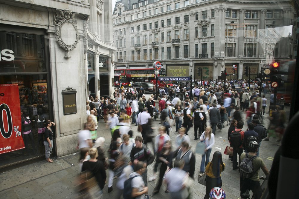
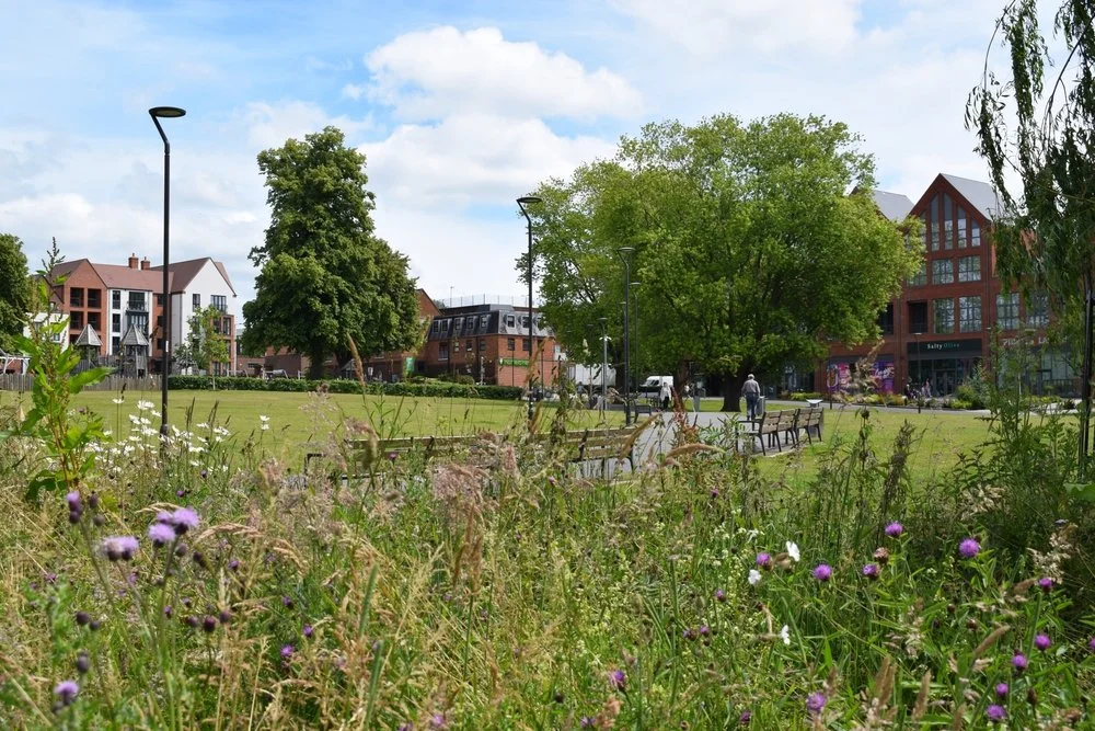
It is virtually impossible to find a planning document that doesn't talk the talk about creating a sense of place. But in practice our current system of speculative site allocations churns out far too many spatially disjointed and unsustainable estates and retail parks. One key element of place that is too often missing is walkability, the simple ability to get to things we need within easy walking distance.
Many of my fellow transport planners will remember how the re-framing of mobility and access problems around the concept of car-dependency gained traction in the media where other transport narratives didn't. This is because it focussed on the lived experience of people, their lack of personal travel choices and the incessant chauffeuring demands placed on parents and carers.
Walkability is one element of placemaking that is inherently measurable. The footflow tool is thus launching at the right time to place evidence-based walkability and footfall metrics at the heart of planning new communities. footflow is designed to measure two things:
Pedestrian accessibility - how easy is it to walk to places I need and want to go to? Contrary to the conspiracy theories about 15-minute neighbourhood planning, it is clear that people place a high value on being able to reach a range of services and facilities in easy walking distance.
Estimated footfall - how many people do we expect to walk past a given building? This is a key metric to ensure that key services and facilities are located where they have sufficient footfall to sustain them.
The footflow team has been developing pedestrian movement analysis tools for over 15 years now. We understand that pedestrian accessibility and footfall metrics need to do the following if they are to play a role as key planning metrics:
highly granular to reflect movement at a human scale, on foot
consistent across existing and new neighbourhoods around the country
trusted by different professional sectors
presented in a meaningful way for public engagement.
We are currently testing the footflow tool in 10 local authorities in the UK. We will be publishing more footflow metrics when the tool is formally launched in the coming months.
footflow team to speak at Loughborough University KTP event

We're thrilled to announce that footflow team will be speaking at the Knowledge Transfer Partnerships in Transport event at Loughborough University on July 22, 2024.
The event will feature discussions and workshops about Knowledge Transfer Partnerships (KTP) projects driving innovation in transport and mobility. This is a great opportunity to meet with industry experts, learn about cutting edge mobility solutions and KTP collaboration.
To find out more and sign up, visit the event page.
Introducing footflow™: revolutionising footfall analysis and planning
Today, footflow™ unveiled a ground-breaking new tool designed to provide local authorities, architects and urban planners with unprecedented insights into pedestrian accessibility and foot traffic patterns. footflow is an evidence-based footfall analysis and planning platform that offers comprehensive benchmarking of pedestrian accessibility at an unrivalled level of granularity.
With footflow, users can harness the power of predictive forecasting to understand how factors such as massing and land use impact pedestrian footfall. This innovative tool empowers decision-makers to make data-driven choices that enhance the walkability and overall liveability of urban environments.
"We are thrilled to introduce footflow to the UK market," said Olumide Odetunde, lead data scientist of footflow. "Our goal is to equip local authorities, architects and planners with the tools they need to create pedestrian-friendly cities that prioritise walkability and sustainability."
Currently, footflow is being piloted in ten local authorities across the UK, with promising early results. As the demand for walkable and liveable urban environments continues to grow, footflow aims to position itself as a leader in pedestrian analytics and planning solutions. With its cutting-edge technology and commitment to data-driven decision-making, footflow is poised to shape the future of pedestrian-centric urban design.
For more information about footflow and its capabilities, please contact the footflow team.
About footflow:
footflow™ is a tool for evidence-based footfall analysis and planning. footflow offers comprehensive benchmarking of pedestrian accessibility at an unrivalled level of granularity and enables predictive forecasts of how building massing and land use impact pedestrian footfall. We are currently testing the footflow tool in ten local authorities around the UK, including BeFirst (Barking & Dagenham), Bolton, Buckinghamshire, Cheshire West and Chester, City of London, Ealing, Hackney, and York. More announcements will follow soon. footfall is a result of a Knowledge Transfer Partnership between the Oval Partnership with its affiliate, Wedderburn Transport Planning and Loughborough University.